Overview / Quick Facts
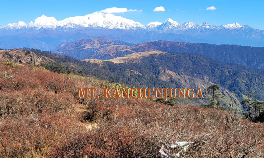
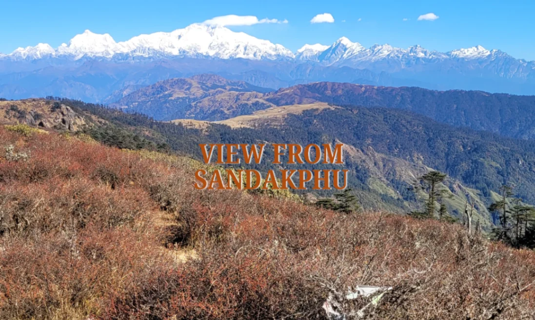
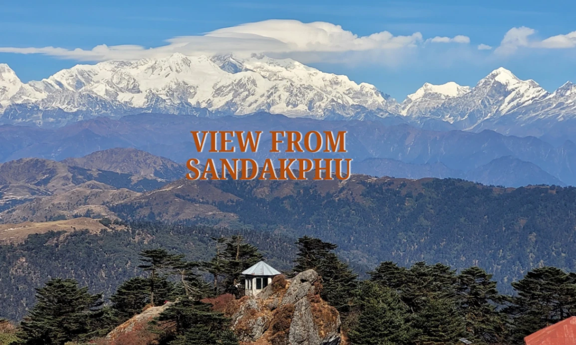
Sandakphu is among the few treks in the Himalayas that does not appear to be an impractically remote place. Although Sandakphu is in West Bengal and on the Singalila Ridge along the India Nepal border. The route is linked with sweeping mountainous scenery, village accommodation, forest features and the famous image of the Kanchenjunga massif with the form of the Sleeping Buddha. Trekker can also see the peaks of the everest group on a clear day at the top and is one of the reasons, which makes this trail so famous in the eastern Himalaya.
At-a-glance facts
Distance: The normal Sandakphu trek covers a distance of between 45 to 56km and distance on Sandakphu-Phalut variations is approximately 65 to 67km.
Difficulty: Medium, can be encountered by beginners with the correct fit but is still difficult on steep ascent and descent days.
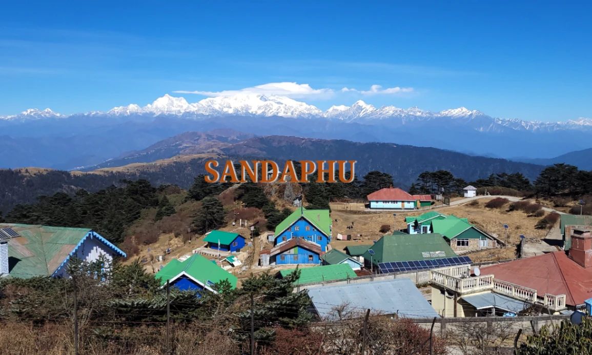
Peak height: At Sandakphu, highest point of West Bengal, about 3,636 m / 11,930 ft.
Best time: Rhododendrons in spring (March-May) and in autumn (October-November) have the clearest views of the mountains.
Quick summary or important points are highlights
- A perfect Himalayan trail with no extreme increase in altitude, perfect in the eyes of the trekkers.
- A famous perspective of the Sleeping Buddha and, on a sunny day, even the Everest-Lhotse- Makalu side of the skyline is also present.
- Mountain-sharp photo: Spring flower, Fall.
- Among the most exotic Eastern Himalayan walks to explore as a travelling person in need of homestays, local culture and scenic variety on a smaller trip.
Kind of Trek: Loop/Linear, Start and End.
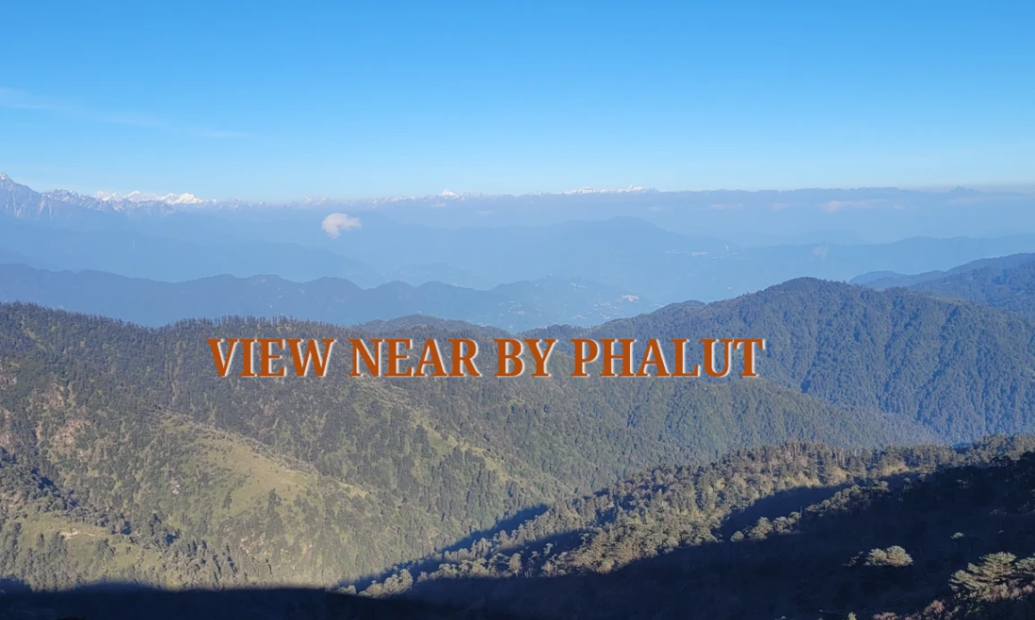
Sandakphu Trek typically is a linear trek, starting at Manebhanjan in West Bengal (once again depending on the route) and ending at Srikhola. The Manebhanjan-Sandakphu loop is a popular trekking route with many trekkers because the rise in the altitude is gradual and there is a lot of scenic beauty that can be enjoyed. The trek is a walk through the Singalila Ridge and the trekkers get to explore the variety of landscape as they traverse dense oak and rhododendron forests to exposed grassy hill slopes and alpine meadows. Other extensions are available to encompass the adjacent mountains including Phalut, where the adventurers have the added challenge.
Why Choose Sandakphu Trek?.
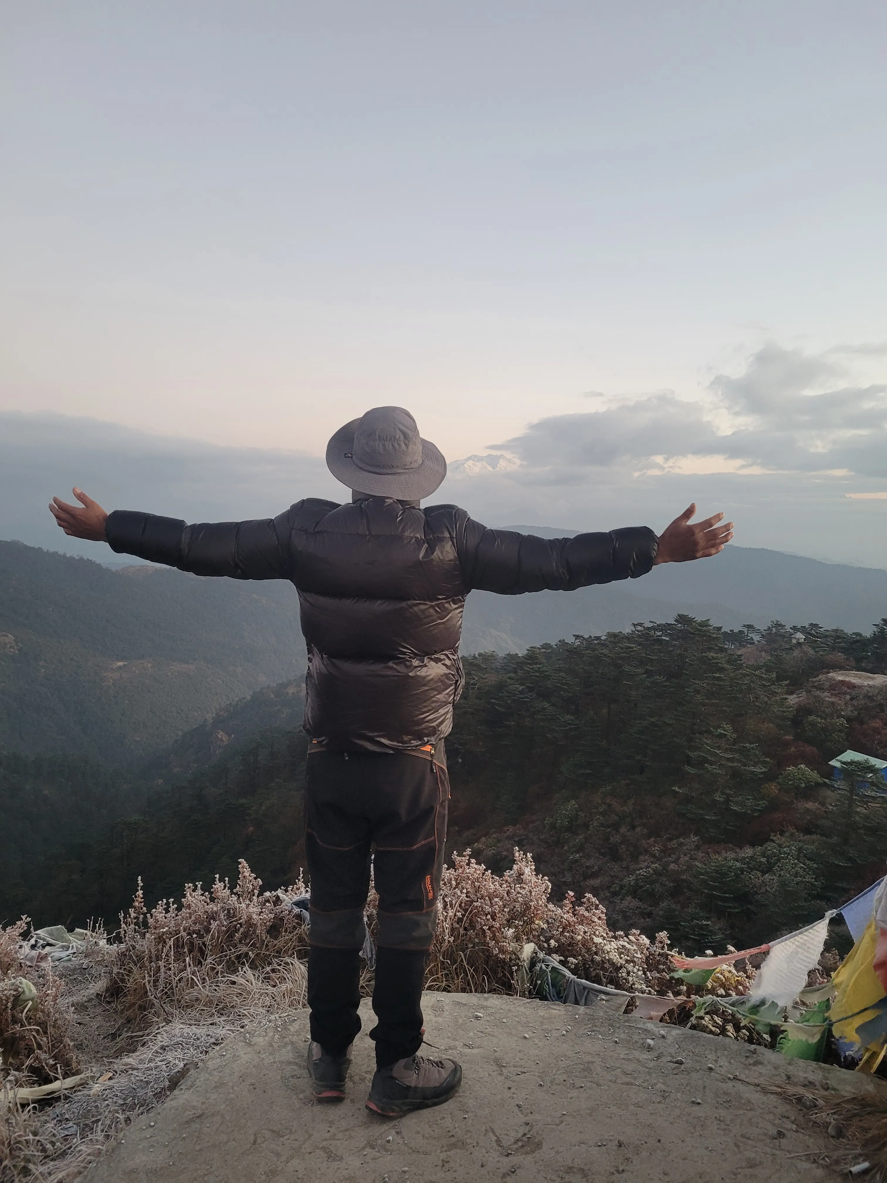
The Sandakphu Trek offers the most beautiful panoramic views of the four highest mountains in the world Kanchenjunga, Lhotse, Makalu and Everest that are visible at Singalila Ridge. Trekkers have a gradual view of the Himalayan landscape, starting with lush green woodland and hilly landscape, to alpine meadows with wildflowers. The Ridge itself is a 360 degree view, best to absorb the grandeur of the mountains and the serenity that peaceful valleys can bring about. The initial mornings have paid off trekkers with golden hues of sunrise on the snow capped mountains, and clear evenings with magnificent reflections of sunsets on the ridge.
Mix Cultural visit: Local Villages, mixed communities such as Gurung, Sherpa,Lepcha and Bhutia communities.
Besides grand view, Sandakphu Trek reveals to the trekkers the rich cultural tapestry of Sikkim and West Bengal border villages. You will see old wooden houses, prayer flags and monasteries in the hilly slopes, this route will pass through mix communiteis such as Gurung, Sherpa, Lepcha, villages of Bhutias. Trekkers work with villagers, and get to know their ways of doing things, their practices, traditions and farming techniques. A good add-on to the trip would be to taste some of the local delicacies made at home such as gundruk, Syninki soup or buckwheat pancakes. Spanish and Radish foment Gundruk and Syinki. Mini Tip: It is a good idea to spend one night in a homestay village that is made of wooden cottages, there it can walk quietly in the morning in terraced fields and the village without a lot of people around.
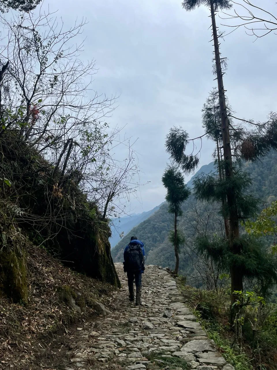
The Adventure Factor: River Crossings, Steep Trails, Alpine Meadows, Hill, Pass.
The Sandakphu Trek is a perfect blend of ordinary adventure and nature. The trail is steep with uphills and descents, rocky, with a few smaller crossings over streams that challenge balance and walking skills. The relief and a sense of triumph over steep climbs come in the form of Alpine open-field meadows on the ridge. The varied landscapes of all sections include thick oak-rhododendron woodland and broad ridges with panorama-views of the Himalayas. There are also other side trails that adventure lovers can choose to use instead of Phalut or Gairibas. Mini tip: Wear trekking shoes with good support and that are ankle higher and carry a walking stick to aid balance on the rocky terrain especially during rain and wet seasons.
Photography Opportunities.
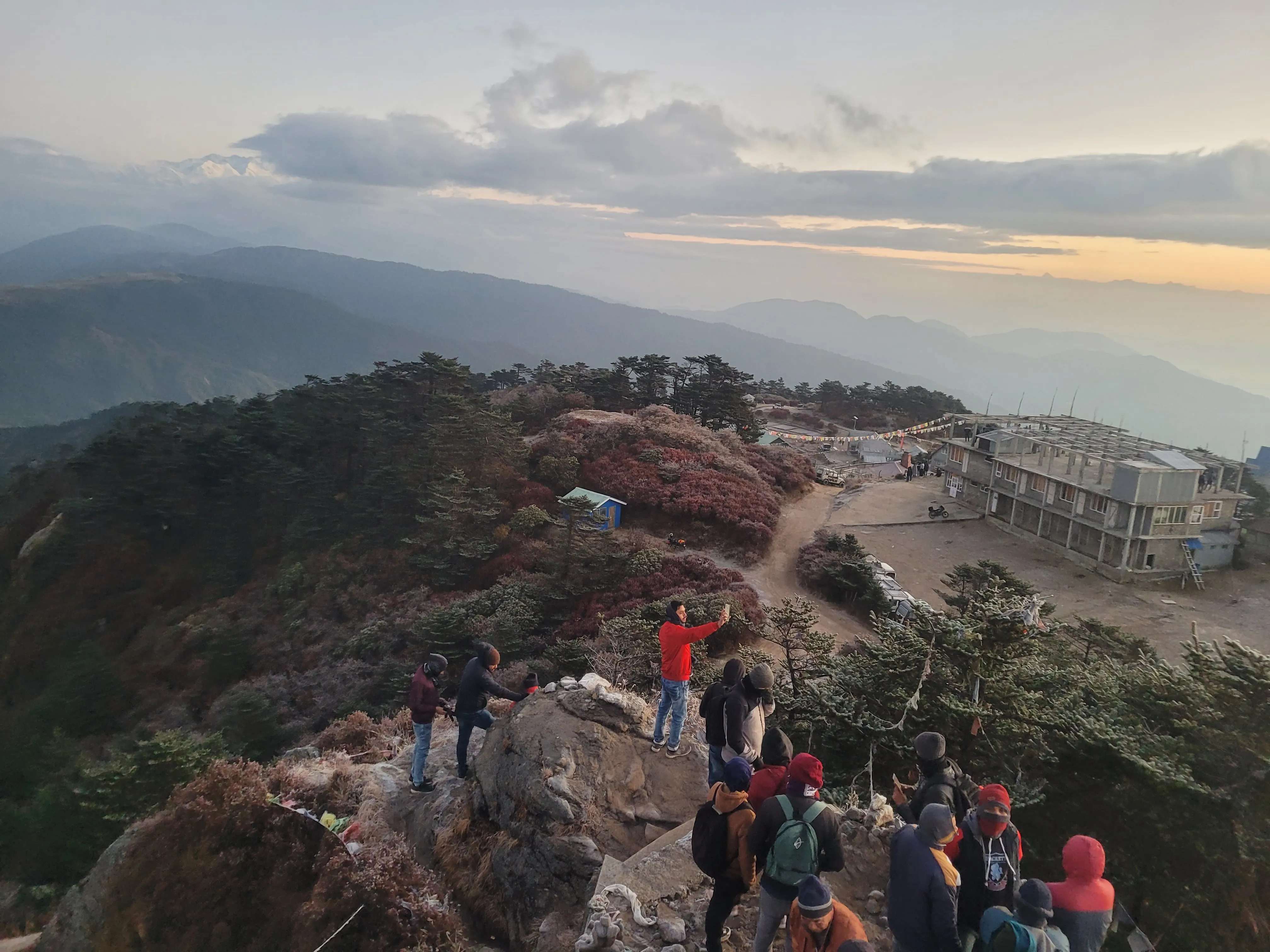
Sandakphu Trek is a photographer dream and the location offers inexhaustible landscape and cultural photography opportunities. The sunrise and sunset effects over the top of the Singalila Ridge create tremendous shadows and lights on the snow-covered mountains. Rhododendron forests are in flower in spring with gorgeous reds, pinks, and whites on a green ground. Trekkers can photograph the villagers at work, traditional buildings, prayer flags waving and streams running through alpine meadows. Trick: Although you have a wide angle lens, always have a tele lens just in case you want to capture a landscape shot, and in case you want to capture wild life, specially Himalaya birds or the barking deer. Panoramic shots of Sandakphu peak will be Instagram worthy because of the golden hour shots in the area. A tripod-stabilized smart phone suffices to take fantastic snapshots on the road to amateur travellers.
Trek Difficulty and Fitness.
Physical Requirement and Level of experience.
Sandakphu Trek is not that challenging and can be handled by the beginners provided they are well trained and the adventurous intermediate. The walks are between 8 to 12 km per day with slow increase in altitude to a range of 300 to 600 meters a day. Trekkers do not need much stamina and they feel good when walking through uneven paths. Some previous experience of trekking would be an advantage, but not that much provided that the pacing is controlled and acclimatization is not omitted. Mini Tip: Go with less hikes further down the mountain in order to condition your body to do consecutive hikes further up the mountain.
Recommendations on muscle-initiated acclimatisation.
Sandakphu peaks at 3,636 metres high; hence, acclimatisationis taken into consideration to prevent mild altitude sickness though. They should not rush, but they must do the night in the lower villages, such as at Manebhanjan or Rimbik, and then climb. The most important one is hydration- at least 3-4 liters of water a day. Rest every 121hours of walking. Mini Tip: Climbs cannot be rushed, must take a climb high, sleep low technique, climbing in the day, and sleeping where possible though at a lower altitude. Light cardio exercises and techniques of breathing can also be used to raise stamina and oxygen uptake before the trek.
Health and safety guide to various types of treks.
Newcomers / first-time: Light backpack, does not walk long distances per day, and sightseeing.
Intermediate/ Experienced Trekkers: Are able to take optional off trails, move at a slower pace on a day to day basis or a Phalut loop.
Summer First Aid Kit: Pack some basic first-aid kit, headache, altitude sickness and digestion medicine. and carry some of dehydration.
Outdoor Wear: hiking shoes, trekking poles and lots of clothes due to changing weather conditions.
Safety procedures:
It is also necessary to state that once you get to forest areas or even go out to visit the great outdoors, make sure that you inform guides of your status, never walk alone where there are dense populations of trees, and last but not least, adhere to the weather anticipations. Balance may be enhanced using walking sticks, and the trails may get slippery due to rain or snow.
And always be aware of altitude sickness; whenever you feel vomiting, a headache, or dizziness, you may think that is some kind of altitude sickness symptom, and in that of case avoid proceeding further on the trek; try to always descend.
Little Tip: When you go outdoor hiking on Himaya, walk slowly with one rhythm and steadily, in particular, when walking a very steep hill or a rocky bit. It is better to leave alcohol or smoking out of the trek; this may aggravate the altitude problems.
And some other neighboring treks and more challenging treks are Goechala Trek | Dzongri Trek
following the below description