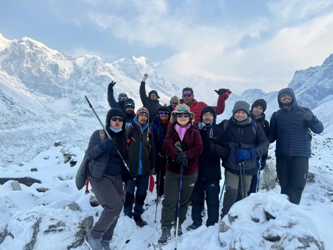
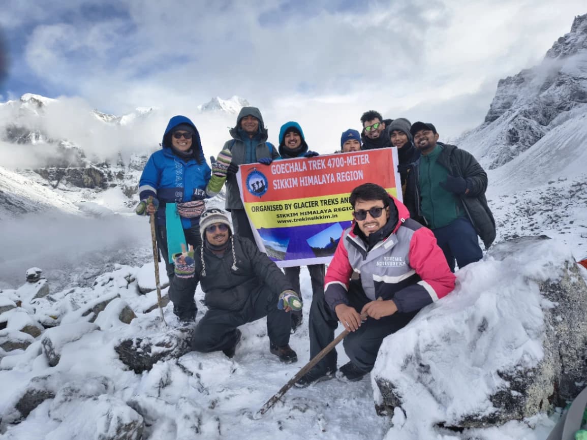
goechala trek images

Goechala trek package-Cost 17800-Itinerar and more

` 17800

This package is applicable for private group and fixed departure, for private group cost is high

10 days 11 nights
Book Now

Region - Sikkim

Best Time - March, April, may, and September, October, November, December.

Total Length Of Trek - 92km

Grade - Difficult

Highest Point - 4700 meters

Cover The Place - Siliguri, Jorthang, Yuksom, Sachen, Tshoka, Dzongri, Kokchurung, Thangsing,Lamuney, Samiti Lake, Goechala 1st

Main Attraction Of The Place - view of Mt. Kanchenjunga, third world hi

Offer

➤ Group booking above 5pax 10% Off

Date

Overview

    Itinerary PDF Download

Goechala Trek-upcoming 2025

Goechala Trek height 4943 meters

Region: Sikkim

Grade : Moderate to Difficult

Duration : 9Night 10Days

Main Attraction of Goechala Trek- 180 degree mountain view and supper view of Mt. Kanchenjunga

Best trek  Season : Pre-Monsoon-March, April and May, Post Monsoon-September to December

Total Distance of trekking Trails : 85-90 km


Goechala trek

The Goechala Trek: Contrasting to it there is a ‘Journey through the Heart of the Himalayas’Goechala trek is yet another splendid trekking hiking destnation in the territory of Indian Himalayas which one can’t really afford to miss. Especially it is famous for the views of Mount Kanchenjunga, the trek is filled with mesmerizing views, challenging treks and you get to indulge in the cultural tastes of the place. Even if it is your firsttime hiking, or if you have been survival hundred times this guide will provide you with all the information that you need to have the best experience in Goechala Trek.

The trek starting from the beautiful town of Yuksom passes through thick forest area, luxuriant pastures and rigorous terrain of mountains. Going up, we transfer to the rhododendron forests where, blossomed, they spill reds, pinks and whites over the forests. These forests are full of wild life some of which are; red Panda, birds hence very suitable for naturalists to visit.

There are so many photographic spots with the most attractive one being the Dzongri viewpoint whereby, one is able to get the best view of the great Himalayas. The view of Sunrise at the top of Dzongri is even more spectacular where Kanchenjunga, Pandim and rest of the peaks turn into different hues with the onset of first light on them. It is rather scenic and will definitely provide the photophiles among you with a perfect backdrop for your trekking photos!

There are certain sections in the trail to this destination that one can consider as difficult thus putting the hikers on the test. Challenges are heigh-stepped hikes, rocky surfaces, and the general test, which is high altitude trekking. Feeling satisfied one is when one has arrived at the final spot of the trek to Goechala pass 1 that is at a whopping height of 4700 meters. I have realized that when one stands up in the morning, all the stress that one has to go through in a day can be masked if one has the best view of the tall Kanchenjunga and the other deodars around.

From the experience of the trek to Goechala, it may be said that to have a perfect trek to Goechala it is better to plan the trek earlier than time fixed for the trek. Equipment should not be a problem since most of the trekking gears are as follows: a good quality boots that are specifically designed for trekking, warm clothing preferably woolens and a good quality sleeping bag. Since the weather might change in the mountains it will be appropriate to wear those clothes that can be layered. Now there are also those that should also be taken for the trek such as the trekking poles, first aid box, and high energy foods. As well, one has to think about the quantity of water consumed equally and take breaks from carrying out risky tasks because of altitude in the area.

Tourism and adventure trekking or expedition in the Himalayas is seen to have the capability to harm the environment and for this; it needs conservation. Special emphasis is made to the campers to follow the bear behaviors that does not produce interferences to the natural habitats and also the ground is not polluted. This in turn enhances the protection of the natural environment for the other generations of the trekkers.

Goechala Trek Difficulty Level

However taking into account the altitude and the routes the Goechala Trek is therefore classified as a moderate to difficulty trek. Trekkers have to be prepare to do long days of hiking, always up and down the hills and for altitude gain. Some of them are that before planning to go for this trek one should have previous experience in trekking and should have good physical health.

Best Time to Visit of Goechala trek

Goechala trek best time to attempted before the monsoons start from April to June and after the monsoon from September to November. These are regarded to be the best periods in mountain viewing because the; the weather is relatively stable with no hindrances to the view of the mountain and the colors of the environment.

Pre-Monsoon April-June.

Spring season specifically during the months of April, May and June before the monsoon season is the most suitable for the Goechala trekking. The climate is considerably moderate compared to the previous months characterized by extremely hot weather, or the wet and even more challenging, that is physically difficult to compass, landscape; this makes the weather most suitable for carrying out the activity. The regions regarding the sky are most times distinct, so one will be in a position to see the adjacent hand hills and grounds.

Post-Monsoon September-November.

As much as monsoon is also good for travelling the preferable months to do this trek are in September, October and November. It is somewhat cooler than the preceding days in this days; but no shades, no tires to hold for trekking, no clouds to cover the majestic views. This period is also much less busy compared to the months before monsoons and that is why many people who like quite and not crowded track select this period.

Note: Therefore, the following measures should be observed so as not to:

What is the Goechala Trek Weather and Temperature during the pre monsoon and post monsoom.

  • Goechala trek weather and temperature during April to June: It is hottest during the middle of the day with means of max range temperature differing from 15°C to 20°C to 68°F. It can even drop to very low figures very sharply and at night the temperature can be as low as 0°C (32°F).
  • September to November: During the day it can be 50 to 59 degree Fahrenheit while during the night it can even drop to 14 to 23 degree Fahrenheit.

What we will carry for the Goechala Trek? some Packing List under here.

• Clothing: Coats, t-shirts, decorative t-shirts, jackets, raincoats, thermal wear, gloves, scarfs/ ear muffs/ hats.

• Footwear: That is still trekking shoes, and the ones with a high ankle support will be perfect.

• Gear: Sticks for walking, a tent, a camping chair, sleeping bag, a headlamp, a backpack which should have a rain cover.

• Other Essentials: A cap or a hat, a bottle of sunscreen lotion, a pair of spectacles/ sunglasses, first aid box, sufficiently carrying water and energy bars.

Permits

Treking within the Kanchenjunga National Park is only allowed with perimts for the trekking people. These trekking permit manage by local travel company, There is some formalities you may have to do with travel company, for this permit you need to submit the any vilid documents lke voter id, adhar card, driving liecence etc, This is for the Indian national trekkers 

For international trekkers 

First you need to apply Sikkim ILP, Innerline permit, this permit you may get at Baghdogra airport or any sikkim and west Bengal border checkpost, like Melli Check Post, Rangpo Check Post, Rammam Check Post, this are the place you may get very easily, what will need for this permit, bring the photocoy of passport, and Indian Visa, Passport Sized picture this 3 things you may submit fot the ILP. and after that permit we can proceed for the trekkigng permit, that trekking permit issue from the department of Sikkim tourism, this permit will get foreigner only through the local trekking company.

Responsible Trekking

• Leave No Trace: Please do not throw any of the waste on the way, carry all the waste back with you to whence you came.

• Respect Local Culture: Promoting every culture the locals have by observing their culture and practices.

• Wildlife: in no circumstance should one try to get close to any wild animal and should not feed them either.

Short Itinerary

Day1- Arrival Baghdogra airport or NJP railway Station and Drive to Yuksom 7 hours

Day2- Yuksom to Sachen 8Km 

Day3- Sachen to Tshoka 8Km

Day4- Tshoka to Dzongri 10Km

Day5- Dzongri to Thangsing 12Km

Day6- Thangsing to Lamuney just 2Km

Day7- Lamuney to Goechala and back lamuney and then Thangsing after Lunch

Day8- Thangsing to Tshoka 16Km

Day9- Tshoka to Yuksom 16Km

Day10- Drive Yuksom to Baghdogra airport or NJP 7 hours 150 Km 

Itinerary

Day 1 (Land at Baghdogra Airport (IXB) or Newjalpaiguri Railway Station and drive to Yuksom.)

Altitude: 5700 ft / 1740 m. Drive Distance: 150 kilometres | It is approximately eight hours. Pickup Point: At NJP Railway Station at about 1000 am (Transportation cost is not included). Lunch: At Jorthang. Last ATM Point: Legship. Accommodation: Guesthouse in Yuksom. When you get to Yuksom, Sikkim’s original capital, you will be impressed by the thoroughly picturesque location of this village set high on the mountain ridges of the Himalayas. As you get into your room, one goes to sleep and enjoy the quiet nature of the place you are in. A small town founded in 1642, Yuksom is aptly known as the ‘gateway to Kanchenjunga’ Afternoon clientele tour of Yuksom and visit to the ‘Norbugang Chorten,’ a revered Stupa- a Buddhist shrine. The evening can be spent just strolling around the park, and simply calming oneself for the next day’s trek Yuksom is quite far from the airport and, thus, it is suggested to reach the town a day before the beginning of the trek. If you have booked your transport with us from New Jalpaiguri to Yuksom, then our representatives shall be at the NJP Railway Station to meet you at 10:00 am. Thus, this is the latest pickup time for general bookings as accepted by the online car rental service agency. Those clients who have booked private companies must go before 3:00pm. When you are driving from NJP to Yuksom, you witness wonderful sights of various Himalayan peaks and also the River Teesta. It also passes across a bridge at Legship which is also the last identified ATM point. Yuksom in west Sikkim was earlier the capital of the state. Yuksom is the starting point of the tourism trade to Mt. Kanchenjunga and also show casing the Cultural sights of Sikkim. It is possible to discover religion-based legends and histories of the state, as well as local customs and presence in society. Next Stop: Jorthang The next tourist destination is Jorthang, for lunch we can have traditional Non-Northeastern style food. Hoping to get there before it gets dark, after lunch we shall proceed to Yuksom. On getting to Yuksom, food and accommodation in guest houses shall be provided for the visitors to take some time and rest. They initially trek towards Tshoka through Dobuk and Kocke Legshap, but it is possible to shop in Yuksom, which is on the way if you did not shop for the trek as planned. The Trek Leader will issue necessary rules to be followed throughout the trek, the general weather of the mountains, and checkpoints as well in the late evening. If you have any disability or health condition that may affect your practicing, please indicate it with the trainer.

Day 2 (Wake Up early and refresh and get ready for the next Yuksom to Sachen 8Km approx and 2642 meters/74100 feet )

Wake up and refresh after that get ready for breakfast, it is breakfast time and off we go to the treks! Few treks start at 9am in the morning and after having your breakfast, start the trekking to Sachen from Yuksom. The route is mainly in the forested areas and offer beautiful views of all the scenery making a promise of the beauty to be seen in the following days. During the climb, look at the beautiful view of some mountain and whenever one is on a break. The next stop you make is Sachen; this is a small village that is located at the backdrop of massive hills. The rest should be spent moving around the village and maybe engaging the people there.

Day 3 (Sachen to Tshoka via Bakhim 2908 Meters/9800 feet)

To Tshoka, you will, thus, need to proceed with your hike after a night of good sleep. The initial hiking is easy because the trail slowly becomes steep, allowing hikers to move up through the forests and meadows with numerous red azalea flowers. Look out for animals like the Himalayan langurs and the red pandas en route here. When you reach Tshoka, the scenic beauty, especially of Mount Kangchendzonga and the other towering mountains, will leave you spellbound. Spend some time to freshen yourself up, as the climate of the eastern region is cooler than the low-altitude areas, and spend the evening by the bonfire with other trekker friends.

Day 4 (Tshoka to Dzongri via Phedang 4000 meter/13480 feet)

Prepare yourself well for a hard day because the journey from Tshoka to Dzongri through Phedang is quite tire some. It involves hiking that comes with slopes up and but the beautiful ariel view of the Himalayas compensates for the hike. When you get to Dzongri Top which stands at an altitude of 4200 meters, it might be advisable to only rest for a few hours before you go out to discover the environs. while after reaching the dzongri there is getting some hot soup and with popcorm, and all your tirdness will relax after having snacks.

Day 5 (Start very early like at 5 in the morning and be prepared for the trek to the Dzongri top, Dzongri top may be very crucial for this trekking because off you will get spectacular view of Mountain, and after get all view get back to camp and do relax and do prepare for the next camp Thangsing. )

Get up and start early to Dzongri Top, the most beautiful point in the trek as here you get the good view of the mountains specially Kangchenjunga in morning at sunrise. After such a splendorous view, go back to the camp to be refreshed for the next day’s activities. Expect the next part of your travel to Thangsing to be through trails that pass on a rich and varied terrain. This segment entails the packing up of the equipment for the next day of shooting as you prepare to move from the scenic viewpoints at Dzongri to the beauty that is Thangsing. The trek of the day is from Dzongri to Thangshing, this is an absolutely gorgeous campsite nestled near the Mount Pandim. The trail provides spectacular scenery of the Himalayas and goes through the area of pastures and rhododendron trees. When you come to Thangshing it is the right time to take a break and enjoy the truly incredible sceneries. Samiti Lake is another glacial lake and one can easily go for a short trek to this spot in the evening.

Day 6 (Thangsing to Lamuney just 3Km away from the Thangsing 4200 meter approx)

Prepare for a more strenuous hike from the town of Thangshing to Lamuney. The path passes through some steep terrains and through high altitude something that makes the hiker really to feel the Himalayas. Upon getting to Lamuney which is at the foothills of Mt.Kangchendzonga, it is advisable to make some few stops and admire the beauty of the mountain. Lamuney is one of the most beautiful camping sites ever, and this is occasioned by the calm environment that is complemented by beautiful scenery. Situated at the base of Mount Pandim, Lamuney is colonized by an incredulous hum of herbs. There is no way one could disagree with the fact that the campsite is a dream place in which one could marvel at the beautiful mountains, clean, clear, and beautiful river, as well as the beautiful country side. This area is without doubt the naturalist’s and the adventurer’s paradise, all of which still stands magnificently, along with the assistance of the royal views and the sleep-inducing nature that Lamuney offers. This medium is suitable for those who can fully immerse themselves in the stunning world and allows the audience to be a part of the attractive world, not far from the violent environment of the real world. Regardless of whether one is hiking these gorgeous trails, lazing on the side of the river in some manner or form, or just bowing down to the terrific sights, Lamuney guarantees a joyful trekking experience. It is possibly a locale where one would never have to substitute the diversion of nature for the reception of happiness in its serene calmness.

Day 7 (Lamuney to Goecha-la pass 1 via samiti Lake)

This day seems to be the most unique day of the whole trek since you are set to reach Goecha La, a mountain pass that stands at 4700 meters. The trek is tiresome, and one has to move through rocky mountains and steep slopes, but the overall sights are well worth the hike. In return, you’ll be presented with excellent scenes of Mt. Kanchenjunga and other snow-clad mountains. If the day remains young and your energy is still not depleted, you can keep on to different passes, stroll a bit in addition, and come back to Thangshing for relaxation if wanted.

Day 8 (Thangsing to Tshoka via Phedang 16km approx)

According to these days’ timetable, one has to go back and retry the route to Tshoka passing by Phedang. The first rate is going to be a lot easier than you anticipate, and this should give you time to look at the geology and contemplate about the calmness. In Tshoka there are no many things one can do expect to have interaction with the villagers. Following that, it progresses to the ability to spend the night.

Day 9 (Tshoka to Yksom via bakhim, Sachen and finally Yuksom 15 to 16Km approx.)

On the final day of the trek, head back to Yuksom via Sachen. While you slide through the known track, think of your prior journey, and lastly, enjoy the view of the great Himalayas. After arriving at Yuksom and successfully completing the Goecha La trek, you might want to take a meal and a little rest.

Day 10 (Departure from yuksom to airport)

Finally, it is time to leave beautiful Yuksom and the people who stayed in the town unforgettable. Go for one last walk through the alley and beautiful paths, and then proceed to your means of transport to the next place you intend to visit. This trek might be challenging and even a bit tiring, but the memories and experiences from this trek will remain with you for the rest of your life and, thus, can be considered an unforgettable journey in the Himalayas.

Photos

Includes & Excludes

Inclusion -

Accommodation.
meals with eggs and vegetables.
Trekking eqipement like tent and sleeping bags mattress.
Permits.
oxygen tank and first aid.
trekking guides.

Exclusion -

While travelling, food.
Insurance.
Porters for bags are available.
personal gears like boots jackets, pole etc.

Useful Info

Additional Tips:

  • Be sure to drink water and take enough time to get used to the new and cooler climate to avoid altitude sickness.
  • Learn some etiquette in Sikkim so that you do not offend the local people and their culture.
  • Take cash, there is no ATM,
  • Trekking in Sikkim requires one to get some important permits for the activity before starting the event.
  • Do not litter or harm the environment in any way, as the Himalayas should be as beautiful as they are.
  • Look within and be alone with your soul as much as you can if you are on the trek for a longer duration.
  • From time to time, it is advisable to sit down and reverse the magnificent view, which encompasses several miles of land.
  • If the appropriate treks are chosen, there is a lot of climbing that may be needed, so get prepared for this in terms of physical and mental stress.
  • Always respect the other people you will be trekking with, and try to be of assistance to them at all times.
  • Just try and get rid of any and all technology for a proper break, and try and learn to enjoy life in the mountains.

FAQ

Q1. Basic details of the Goechala Trek.


A1: Answer 1: The Goechala Trek: Again located in the Indian Himalayas and famous for the view of the Mount Kanchenjunga, steep trail and Neighbourhood feel.


Q2: From where does one start the Goechala Trek?


A2: The trek begins at the fine view of the city known as Yuksom found in the Indian state or kingdom of Sikkim.


Q3: While on the Goechala Trek what natural environment or view should the hikers be prepared for? A3 Using machineries Explorers can way much vegetation, foliage, meadows, rocks, lots of tree like the Rhododendrons and tremendous peaks of the mountains. It is also relevant to mention that the term reddish panda and numerous bird types among the list of animals that can be observed within the territory.


Q4:Comparatively, which of the attractions, do you think is the highest high, in taking the Goechala Trek?


A4: That is the view from the Dzongri point of view where trekkers are advised to wait to witness a perfect sunrise over Kanchenjunga, Pandim and other such peaks.


Q5 To what extent the Goechala Trek could be classified as difficult?


Thus, designing the focus as moderate to ‘difficult’ take into account the choice of Goechala Trek. It entails mountaineering, mountain ascending, mountain hiking, rolling areas regarded as having steep slopes and more any terrain that tests the health of people and previous experience in mountain treks.


Q6: in your opinion, what is the biggest highlight of Goechala trek?


A6 In response to this question, indeed the highest point is the Goechala Pass 1 which is at about 4, 7 hundred meters or at about 15,420 ft.


Q7;What are the requirements for Goechala Trek for a hiker?


A7: Among them are high quality proper trekking boots, heat clothing, a sleeping bag, layer clothing, trekking poles essential first aid kit, high energy foods and water.


Q8: In which of the following months is the Goechala Trek mostly preferred and done?


Geographically, a good outcome is produced between April and June prior to monsoon and between September and November following monsoon because the climate is clear and the mountains in the backdrop are visible.


A9: Regarding the permits needed for the Goechala trek what are the permits hikers need to obtain? A9: With regard to the questions you posed with added questions, It is necessary to get a permit when trekking in Kanchenjunga National Park. These permits can be obtained from the check post of the forest which is located just outside the Yuksom whereas one is approaching from the Pelling. The presented identification cards and passport size pictures are necessary to be produced by the trekkers at the time of assessment.


Q10: What should trekkers do concerning the environment?


A10: Directly, trekkers should not pollute the environment, and it is extremely obligatory that trekkers should not offend the subculture and try their best to minimize impact on the wildlife. They should also; adhere to the ‘’tread lightly’’ and ‘’leave no mark’’ policies to lower their influence on most of their activities on the environment.


Q11: What is the ecological environment that perhaps hikers might encounter during the Goechala Trek?


A11: They also meet the nature; the pink panda and rather many chook species can be observed in the grove of the rhododendron.


Q12: During the Goechala Trek is there any precise condition that a person should not break?


A12: They should know and memorize the facts about height, take water with them, be aware of people’s behavior in the area, take money with them, be prepared physically, and enjoy the nature without thinking about the time.


Q13: Kinds of lodges and shelters that tourists can find on the way during the Goechala Trek?


A13: Traditionally, the accommodation involves herding in some places with names likes Sachen, Tshoka, Dzongri, Thangshing, Lamuney amongst others. These campsites are evidently unsafe for rest and recreation to take place in the aforementioned area.


Q14: Can you enlight me on some of the popular camps in the Goechala?


A14: Major camps are yuksum being the starting point, Sichen, Tshoka, Dzongri, Thangshing and Lamuney. Speaking of each campsite it paints an entirely different picture and an opportunity of coming across the flowers and the Fauna of the campsite.


Question 15 from this section is: Why the viewpoint is strategically important at Dzongri? A15 They need to see the Dzongri view to know how the inclined Himalayas look like, that how Kanchenjunga and Pandim changes its color when it dawns.


Q16: How trekkers are conditioned in make-up for the altitude of the Goechala Trek?


A16: Trekkers have to regulate the particular check of altitude, always get sufficient coda, do not over strain in the first place and of course, do not forget to use the medicine for sickness of altitude.


Q17: If passing through the Goechala Trek, what components of the plants’ value should not be understated?


A17: They are things like viewing the even of nature like Rhododendron, sighting of Dzongri, Samiti Lake and the majestic view of Kanchenjunga and other peaks from Geochela.


Q19: In fact, what cultural informative reports are the travelers able to obtain on the Goechala Trek?


A19: It is possible to interact with those who are the inhabitants of Sikkim, provide monasteries, acquaint the travelers with the non-tourist face of the area and its ethnography.


Q 20 To how many days is It possible to get foods at trek?


A 20: For the most part the trekkers manage to get relatively guilt free, healthy food which is mostly cooked at camps. High strength means the amount of energy supply in foods, and since the requirement is mostly quite high, it is recommended to convey foods of high strength.


Q21: What action is favored by the trekkers concerning the disposal of all the wastes that would have been produced in the process of trek?


G21:­? Through the ‘’Leave No Trace’’ the trekker should only take litter they receive and make sure they have dispersed litter around the environment. Waste collection at a particular location is inbound to occur.


Q22: What types of climate can a trekker encounter during the Goechala trek ?


A22: Depending on the time the weather might be drastically different. This is pre-monsoon that is April, May and June which has clear sky though relatively hot and post monsoon which ranges from September to November gets slightly cooler with clearer mountain vistas. Cold tends to rise during the night and because of this attribute is even more manifest if he or she is in the highland area.


Q23: Are there any condition that the hiker has to meet especially concerning the environment in the course of the trekking?


A23: And you should have a first aid package in your pocket; one must know the climate and how to best dress appropriately for it and to drink adequate amounts of water; and too much, for example, it is forbidden to stand on cliffs. Trekking should also be done with a guide or at least with others so that in case one gets lost, there are others to seek help from.


Q24 In what ways are the trekkers beneficial to the neighboring communities while they are on the trek?


A24: Trekkers are supposed to be a positive input to the neighborhood communities since they get their guides and porters from the locals and buy the locals’ products; therefore, they should respect the cultures and disturb the environment in any way.


Q 25 Following are some of the most probable plants or animals that one may come across during the trekking to Goechala.


A25: There are rhododendrons among the plants in their wildlife and among the animals there are purple pandas; Himalayan langurs; and several chickens.


Here are the more answers to the frequently asked questions in which the information about Goechala Trek, the cultural aspect concerning the trek, and the guide to undertaking the Goechala trek are highlighted.

Goechala trek map

Yuksom to Goechala Trek map

goechala pass trek map

{{title}}

{{ s.response }}