Position the goechala trek as a structured, high altitude Himalayan expedition in Sikkim that needs to be paced properly, be physiologically prepared and understanding of the terrain development. The American trekkers tend to underrate the combined effect created by altitude gain, weather changes and long walks. This roadmap-like book guides the whole trail into reality by breaking it down into day by day consciousness such that first time high-altitude travelers can train realistically. It is accuracy and ready, rather than romanticism.
Getting to know the Goechala Trek.
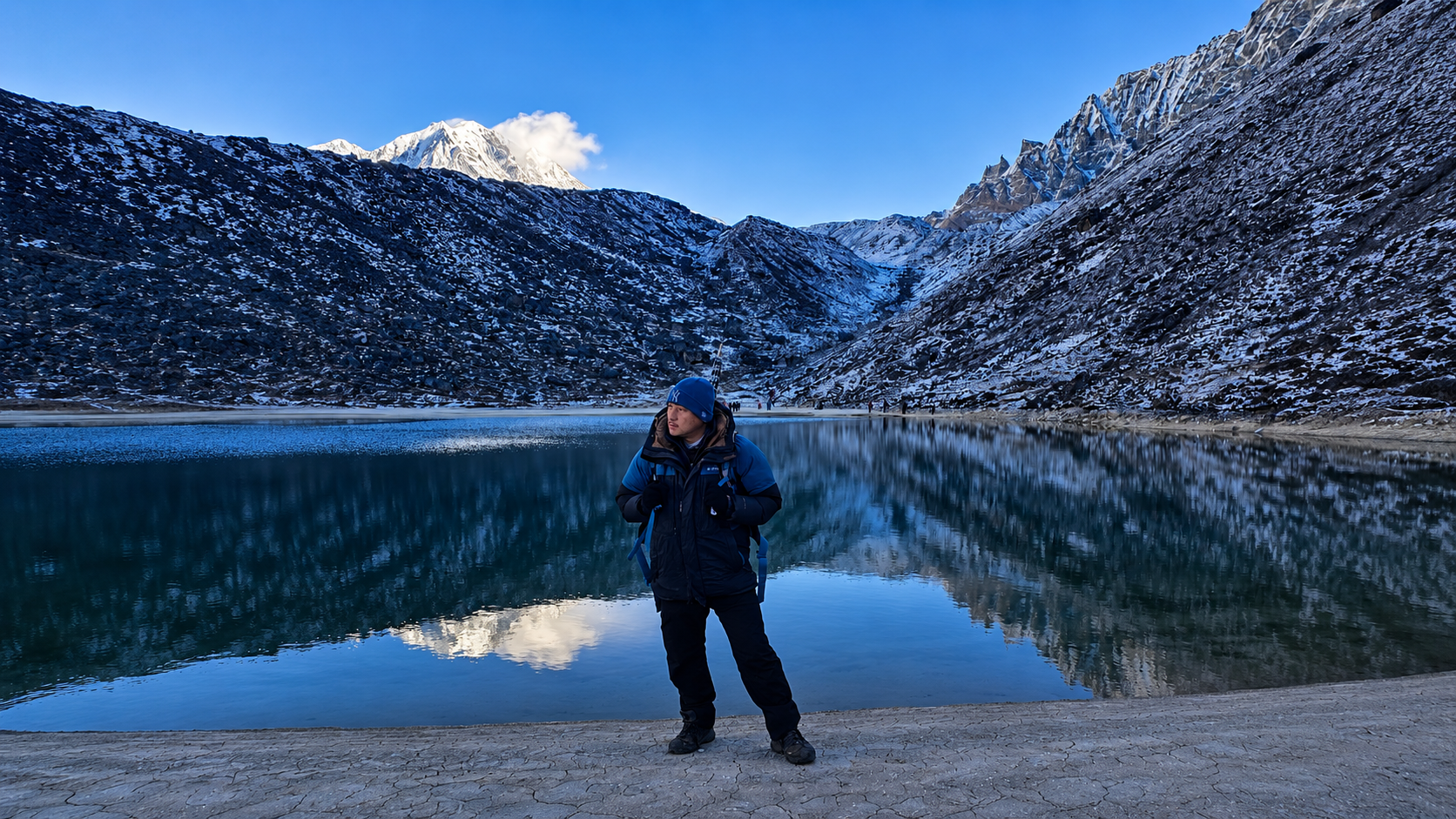
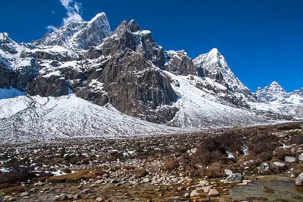
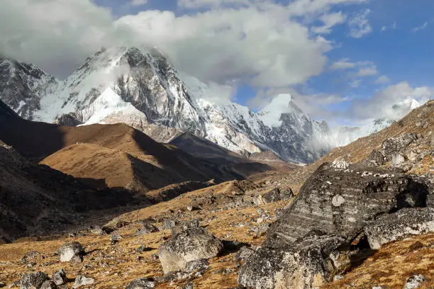
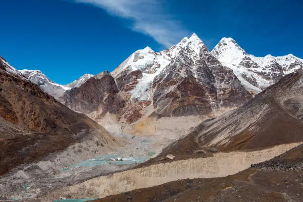
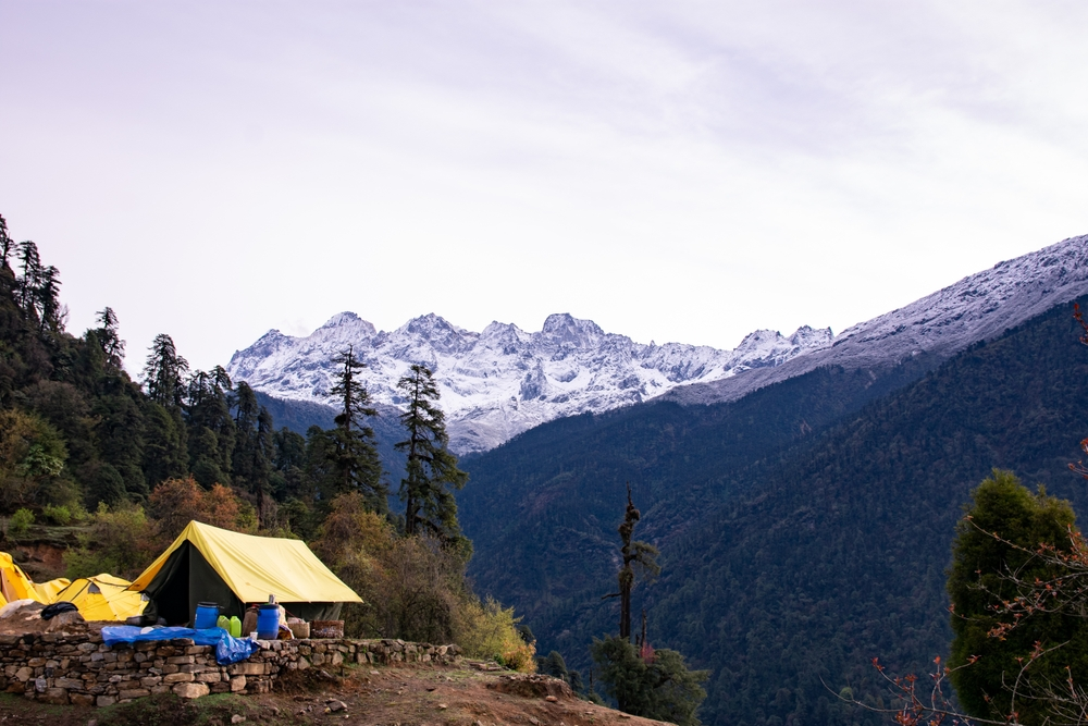
The goechala trek is approximately 90 kilometers round trip and it reaches heights of approximately 16,000 feet. Above 12000 feet, the oxygen concentration falls drastically and adjusting to altitude becomes necessary in safety. Every day segment comprises of 6-9 hours of movement on unstable terrain- rock steps, wooden bridges, forest trails, and open alpine country. This expedition is strenuous and it can be described as earnest initiation about the Himalayan trekking.

Table 1: Goechala Trek Overview
| Category | Information |
| Total Distance | ~90 km round trip |
| Maximum Elevation | ~16,000 ft |
| Difficulty Level | High |
| Standard Duration | 8–10 days |
Table 2: Campwise Breakdown of the Altitude
| Camp Name | Approx. Altitude |
| Yuksom | ~5,640 ft |
| Tshoka | ~9,700 ft |
| Dzongri | ~13,000 ft |
| Thansing | ~12,900 ft |
| Lamuney | ~13,700 ft |
| Goechala Viewpoint | ~16,000 ft |
Full Itinerary Breakdown
Day 1 – Yuksom to Sachen
At the goechala trek, start off with an average climb. The road passes across forests, rivers and small bridges. This section is very humid and the trekkers need to ensure that they are well hydrated. This is the day which establishes the pacing.
Day 2 – Sachen to Tshoka
The climb becomes steeper. Tshoka is a small settlement to which one gets by long wooden bridges and several uphill passes. Unacclimatized trekkers can experience the initial symptoms of the strain of the altitude. Slow pacing is essential.
Day 3 – Tshoka to Dzongri
Sharp increase in elevation, lower temperature, and initial transition to alpine terrain is experienced here. Trekkers are required to follow a regular pattern of breathing and take regulated rests. The earliest broad mountain views are those provided by Dzongri.
Day 4 – Dzongri Acclimatization Day
This day is not optional. Dzongri top walk aids adaptation to altitude. There is no better risk-reduction method than acclimatization days. The rest, hydration, and constant movement is important.
Day 5 – Dzongri to Thansing
The landscape is exposed to broad fields. The increased altitude is more felt when the stamina is lowered and the walking speed is slowed. At night it is icy calm at Thansing.
Day 6 – Thansing to Lamuney
Shorter route, although the height makes even the gentle slopes difficult. The last base is Lamuney and then the summit viewpoint. The nights are very chilly here.
Day 7 – Lamuney to Goechala Viewpoint and Back
The most challenging day of the goechala trek. Start as early as 2–3 AM. It will be cold, windy and air is thin. The process of climbing to the vantage takes time, not rapidity. Straight back to Thansing or Lamuney.
Days 8–10 – Return to Yuksom
Downward movement decreases the strain on the altitude but elevates the load on the knee. The use of controlled stepping, trekking poles, and hydration helps to make the travel safer. One may have to experience longer forest corridors because of fatigue.
Optimal Itinerary Success Seasons
There are two windows with stabil conditions in trekking:
• April to early June
The second, late in September to mid-November.
It is during these months that there are clear skies and controllable temperatures. During the monsoon months, it is heavy with rain and mudslides. The winter season brings a lot of snow and frozen roads, becoming dangerous to beginners.
Corporeal Preparation of the Itinerary
It is important to note that trekkers need to develop stamina before they can venture out this route.
Training should include:
• Walking 6–9 miles regularly
• Walking up steep hills or up the stairs.
• Core and leg strengthening
• Meditative breathing at a slow rate.
The condition of the backpacks is enhanced by adding weight to them.
Endurance training is useful in overcoming stresses at high altitudes and trekking hours.
Weather Pattern Awareness
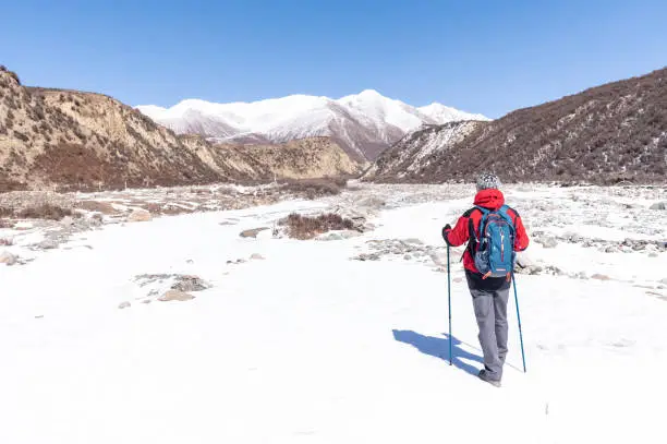
Weather shifts rapidly. Afternoons may be warm and then in a few minutes turn icy evenings. Fog usually increases in the afternoon making visibility bad. The snows and cold winds are frequent about the higher camps. Rainproof garments, insulated, and heavy duty footwear are necessary.
Permit Requirements
Trekking is heavily controlled in Sikkim. Every trekker is supposed to be in possession of the necessary permits such as Protected Area permits and the Restricted Area permits where foreigners are concerned. There is also a need that the U.S. trekkers have valid identification with them at all times. Checks of permits are at Yuksom and in other designated places.
Food and Water Availability
The foods eaten are rice, lentils, vegetables, eggs, and plain soups. These are simple meals which are rich in carbohydrates as a source of energy. Camp areas have water sources which must be purified using purification pills or filtered. Never drink untreated water.
Essential Gear Checklist
The gear should be operational in advance.
• High-ankle trekking boots
• Layered thermal wear
• Waterproof jacket and pants
• Sleeping bag that is freezing temperature.
• Trekking poles
• Headlamp including spare batteries.
• Portable filter or purification tablets of water.
You should never go on the hike with new untested boots. The blisters may interfere with the progress.
Altitude Safety Expectations
Even the fit is affected by altitude.
Ordinary symptoms: headache, tiredness, dizziness, loss of appetite.
The only actual remedy of increasing altitude sickness is descent.
Hydration, pacing and acclimatization are beneficial in reducing symptoms but not risk reduction.
Quotes for Emphasis
The altitude is something you do not struggle with but instruct.
It is better to drive at a steady speed than to have a speed advantage which could save your body.
Quality equipment is more efficient in mitigating risk than passion.
Considerations Logistics
Arrange transport to Yuksom, both internal Sikkim permits and road. One would want to book guides and porters early in the peak season. Always have cash because in the rural places, electronic payments might fail.
Cost Breakdown
The typical categories of budget are:
• Permit fees
• Guide and porter charges
• Accommodation in Yuksom
• Gear rental
• Food along the trek
• Sightseeing and other transportation to Sikkim.
Budgeting is more realistic, and this guarantees a more secure supported trekking experience.
The errors that First-Time Trekkers need to be aware of
• Overpacking
• Skipping acclimatization
• Walking too fast at altitude
• Drinking untreated water
• Underestimating the changes in weather.
• Using brand-new boots
• Trainers go to work without adequate fitness training.
Pre-Trek Conditioning Schedule
• Weekly steep hikes
• Long walks (6–8 miles)
• Leg and core strengthening
• Aerobic conditioning
• Weighted backpack practice
Adequate training stabilizes the performance in the high-altitude areas.
Environmental Responsibility
Sensitive forest and alpine ecosystems are traversed by the goechala trek. Trekkers should remain on designated paths, do all litter and not to upset the wildlife. These actions conserve the natural environment and preserve the quality of trails.
FAQ
What is the distance of the goechala trek?
About 8-10 days including acclimatization days.
Can start-ups go on the goechala trek?
Yes, but when properly trained in the physical.
Which season is the most excellent trekking season?
April and early June and late September through mid-November.
Is this itinerary going to require me to have permits?
Yes. There are several permits because of restricted and guarded zones in Sikkim.
What is the maximum altitude?
At the main point of view are about 16,000 feet.
Conclusion:
The goechala trek does not happen without a proper planning, restrained time-keeping and physical training. This itinerary breakdown helps the trekkers of the United States to have a true image of every stage so that they could prepare at the altitude, weather variations, and hours in long trails. The route will be an excellent source of scenery with the right training, equipment and with respect to the ecological regulations it will be a complete high-Himalayan trekking route.