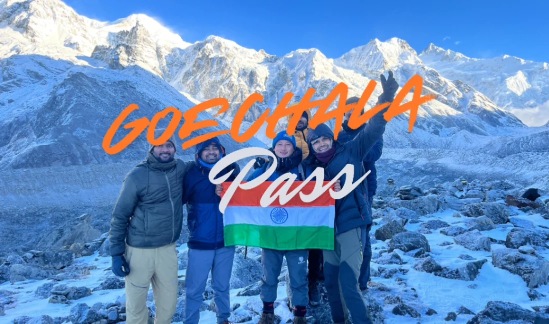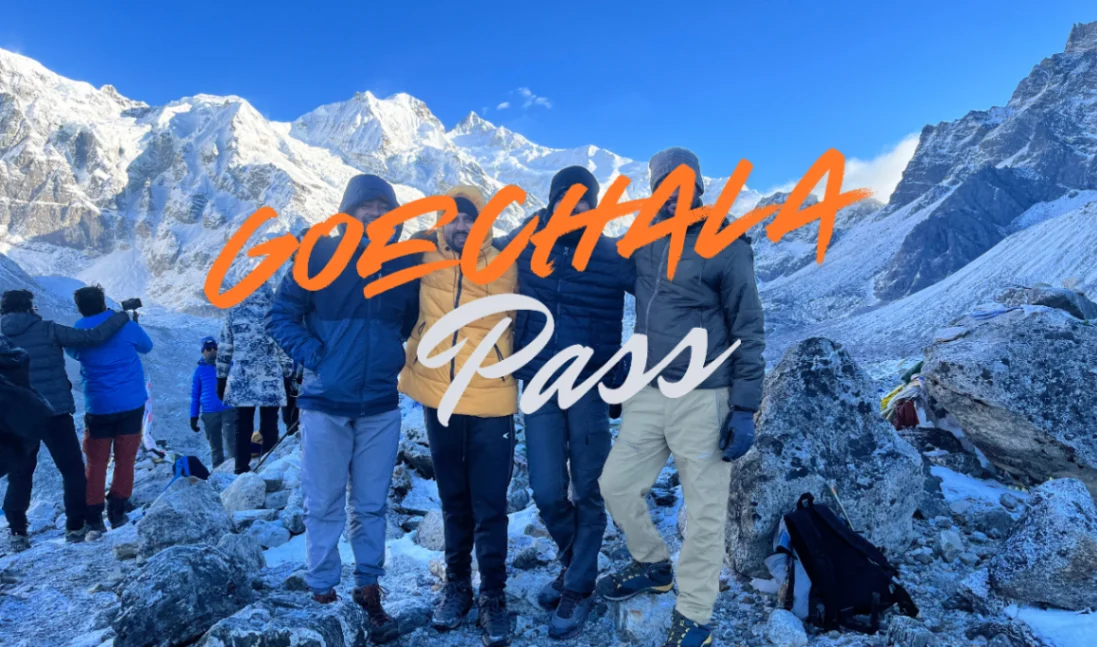
I have led the Goechala Trek for fifteen years, and I have not yet found a route in the Indian Himalaya that combines beauty, difficulty and accessibility in quite the same way. The trail begins in a town where the kings of Sikkim were crowned in 1642, climbs through some of the densest rhododendron forest in the country, breaks above the treeline into an alpine world of yak meadows and prayer flags, and ends — on the right morning — with the entire west face of Kanchenjunga lit up in pre-dawn gold, close enough that you can pick out the individual ridgelines.
This guide is written from inside that route, not from a desk in another city. Every altitude, distance and walking time in this article matches what my team and I record on the trail across roughly twenty Goechala departures a year. If you are deciding whether the Goechala Trek is right for you in 2026 — or if you are already booked and want to know exactly what is coming — read this from top to bottom. Everything you need is here.
Goechala Trek Quick Facts
Before the long-form sections, the numbers and labels you need to make a decision:
| Attribute | Detail |
| Region | West Sikkim, Indian Himalaya |
| Trail name | Goechala Trek (also written ‘Goecha La’ or ‘Goeche La’) |
| Start / End point | Yuksom (1,780m) |
| Highest point | Goechala Viewpoint 1 — 4,500m (approximately 14,800 ft) |
| Duration | 9 nights / 10 days from Yuksom; add 1 day if travelling from NJP/Bagdogra |
| Trek distance | Approximately 80 kilometres total (loop) |
| Difficulty | Moderate to Difficult |
| Best time | March–May (spring) and September–December (autumn) |
| Suitable age | 13 to 60 years (with medical clearance over 55) |
| Cost (Indian) | ₹19,500 per person (₹22,500 list price) |
| Cost (Foreign) | $400 per person (excludes ₹5,000 KNP permit) |
| Permits needed | Inner Line Permit, Khangchendzonga National Park entry, Sikkim Police registration |
| Mountain views | Kanchenjunga (8,586m), Pandim, Tenchenkhang, Kabru, Frey, Rathong, Talung, Simvo |
| Mobile network | Patchy BSNL/Jio until Yuksom and Tshoka only; no signal for 7–8 days on trail |
Where Is the Goechala Trek and Why Is It Special
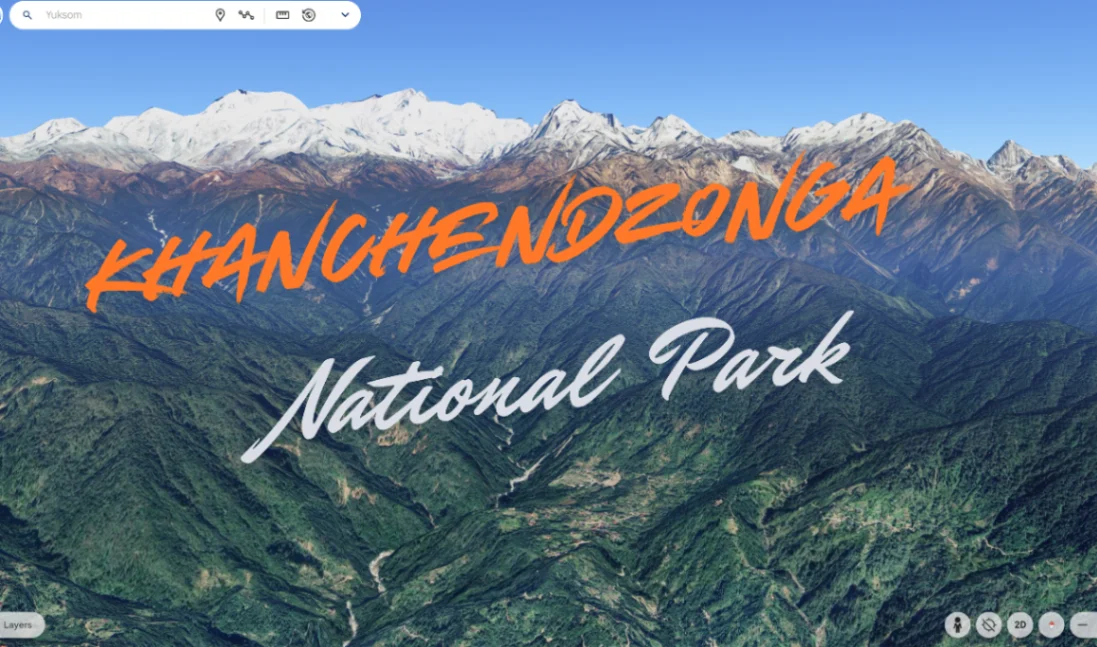
The Goechala Trek lies inside the Khangchendzonga National Park, a UNESCO World Heritage Site that covers nearly a third of Sikkim’s land area. The trail begins at Yuksom — pronounced ‘yook-som’, meaning ‘the meeting place of three lamas’ — which served as the first capital of the Buddhist kingdom of Sikkim from 1642 to 1670. From Yuksom, the trek climbs west through subtropical forest into the Prek Chu valley, traverses high alpine meadows at Dzongri and Thangsing, then turns north along a glacial moraine to reach Goechala, a pass that sits at the very foot of Mt Kanchenjunga’s south face.
Three things, in my experience, make Goechala genuinely special — not just marketing copy:
- Closeness to Kanchenjunga. There are taller mountains in the world, but very few trekking routes that bring you this close to one of the highest. Standing at Viewpoint 1 with the south face filling your entire field of vision is a different experience than seeing Everest from Kala Patthar — Kanchenjunga is right there, not on the other side of a valley.
- Five distinct ecological zones in ten days. You walk from subtropical broadleaf forest at 1,780m, through temperate oak-rhododendron at 2,800m, into silver-fir conifer belt at 3,500m, then alpine meadow at 4,000m, and finally rocky high-altitude scree at 4,500m. Very few treks in India compress this much ecological variety into a single loop.
- Cultural depth. Yuksom is not a trailhead built for tourism. The Norbugang coronation throne, Dubdi monastery (the oldest in Sikkim), Kathok Lake and the village chortens are still in active religious use. You start your trek in a place that means something.
Read more: Trekking from Yuksom: the trailhead guide
Goechala Trek Itinerary — Day by Day
The standard Goechala Trek itinerary is 9 nights and 10 days from Yuksom, with one or two contingency days that we typically use at Dzongri for acclimatization. Here is exactly what each day looks like in 2026.
Day 1 — Arrival at NJP / Bagdogra, transfer to Yuksom
Distance: 150km by road from NJP railway station or Bagdogra airport.
Travel time: 6–8 hours. Altitude: Yuksom 1,780m.
You either arrive at New Jalpaiguri (NJP) by overnight train or at Bagdogra airport by morning flight. Our shared vehicle picks up trekkers between 9 AM and 11 AM and reaches Yuksom by evening. The road climbs continuously after Jorethang, passes through Geyzing and Pelling, and finally drops into the Yuksom basin. We recommend motion-sickness tablets if you are prone — the road has more than 200 bends after Pelling.
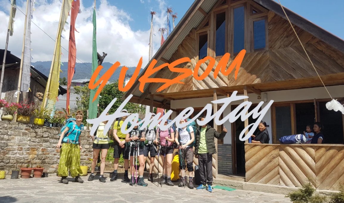
On arrival in Yuksom you will be settled into a guesthouse or homestay, briefed on the trek, and given a final gear check. Spend the evening walking up to Norbugang or Kathok Lake — gentle altitude gain helps acclimatization.
Day 2 — Yuksom to Sachen
Distance: 8km. Walking time: 5–6 hours.
Altitude: Sachen 2,180m.
The first real trekking day is gentle but not short. You leave Yuksom through farmland, drop down to the Prek Chu, and cross a series of suspension bridges over the Phamrong and Tshushay rivers. The forest is dense and mixed — oak, magnolia, alder and the first rhododendrons appear at higher sections. Pace is more important than speed on Day 2: walk steady, drink water every twenty minutes, eat your trail snacks even when you do not feel hungry. Sachen is a small forest camp at 2,180m and your first introduction to tent life.
Day 3 — Sachen to Tshoka via Bakhim
Distance: 7–8km.
Walking time: 4–6 hours.
Altitude: Tshoka 2,950m.
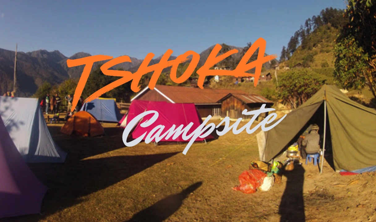
The trail climbs more seriously today, with a long pull up to Bakhim (2,740m) where there is a trekkers’ hut and the first proper view of the surrounding ridges. From Bakhim, another 2km of forest brings you to Tshoka — a small village of about ten houses that sits on a clearing facing Mt Pandim. Tshoka is one of the most photographed campsites on the trek. In April and May the surrounding forest is solid with rhododendron blooms in seven colours.
Day 4 — Tshoka to Dzongri via Phedang
Distance: 8–9km.
Walking time: 6–8 hours.
Altitude: Dzongri 4,020m.
This is the first hard day. The trail climbs through deep rhododendron forest to Phedang (3,650m), then out of the treeline and across open alpine meadow to Dzongri. The altitude jump is significant — about 1,070m of gain in one day, which is on the edge of acclimatization safety. We move slowly, take a long lunch break at Phedang, and reach Dzongri by mid-afternoon. Many trekkers feel the first mild symptoms of altitude here: light headache, slight breathlessness, broken sleep. This is normal and manageable if you drink water and eat dinner properly.
If we have any concern about a trekker’s acclimatization, we use a contingency day at Dzongri for a short hike to Dzongri Top (4,200m) and back. The extra day is included in our package — we do not charge for it and we do not skip it to save time.
Day 5 — Dzongri to Thangsing
Distance: 9–10km.
Walking time: 5–7 hours.
Altitude: Thangsing 3,840m.
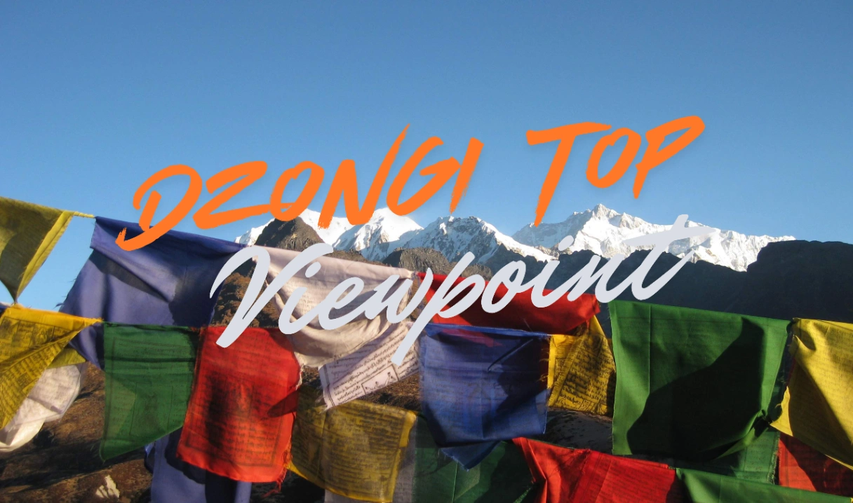
An early morning hike up to Dzongri Top (4,200m) for the Kanchenjunga sunrise — this is one of the great mountain mornings of the Himalaya, with Kanchenjunga, Pandim, Kabru and Rathong all lighting up within seconds of each other. After breakfast we descend to Kockchurang (3,650m), cross the Prek Chu on a steel bridge, and climb to Thangsing, a wide meadow under the south face of Mt Pandim. Day 5 is shorter than Day 4 but you will feel the previous day’s effort in your legs.
Day 6 — Thangsing to Lamuney
Distance: 4km.
Walking time: 2–3 hours.
Altitude: Lamuney 4,200m.
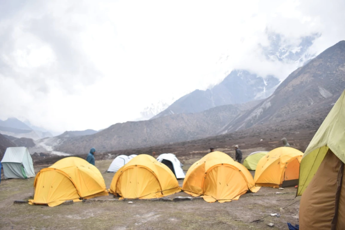
Deliberately short. Lamuney is the highest camp of the trek and the launchpad for the summit-day push to Goechala. We arrive by late morning, have a long lunch, and rest the entire afternoon. Spend the time hydrating, eating, and laying out the next morning’s gear so you do not have to think at 3 AM. Trekkers who try to do anything energetic at Lamuney typically pay for it the next morning.
Day 7 — Summit day: Lamuney → Goechala Viewpoint 1 → Lamuney → Kockchurang
Distance: 10–12km total.
Walking time: 7–9 hours.
Maximum altitude: 4,500m (Viewpoint 1).
Final camp altitude: Kockchurang 3,650m.
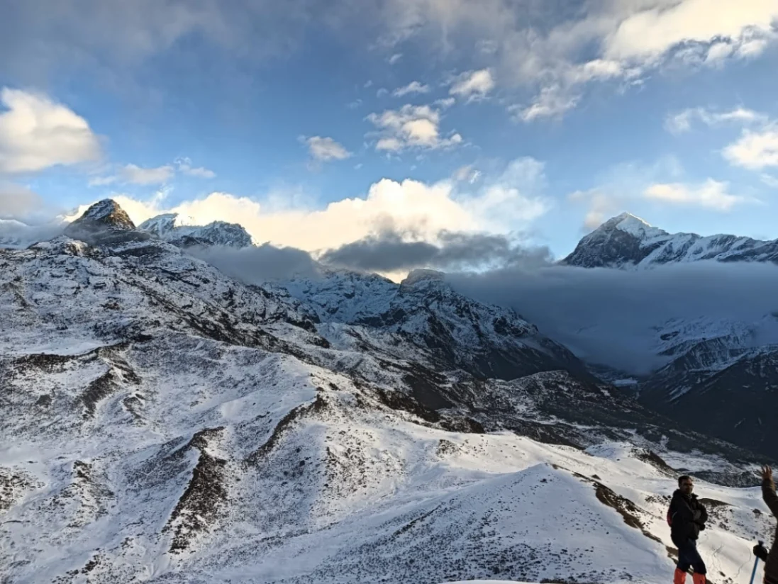
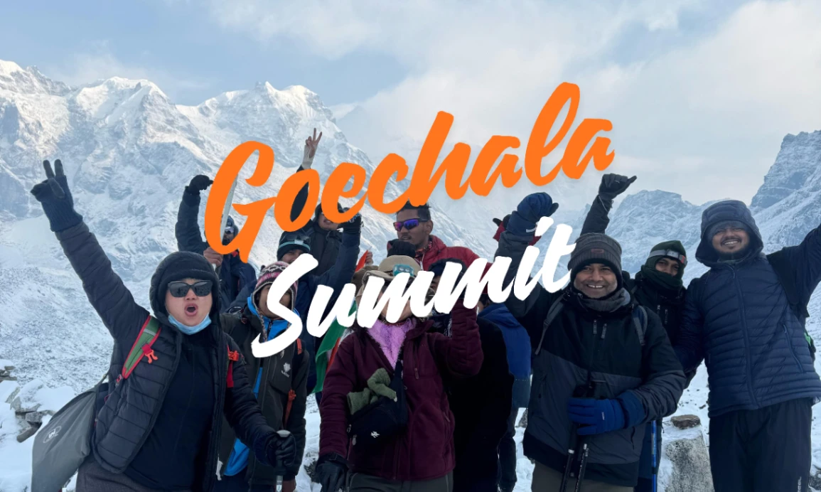
Wake-up is at 2 AM. We leave camp by 3 AM with headlamps to be at Samiti Lake (4,300m) by sunrise and at Goechala Viewpoint 1 by around 7 AM. This is the longest, coldest and hardest day of the trek. The path from Samiti Lake to Viewpoint 1 is rocky moraine with no shelter — wind chill can drop the effective temperature below -10°C even in May. But the view at Viewpoint 1 is what the entire trek is built around. On a clear morning, the entire south face of Kanchenjunga rises directly in front of you, with Talung, Kabru, Rathong and Frey arranged along the ridgeline.
Most commercial Goechala treks turn around at Viewpoint 1. Viewpoint 2 and the actual Goechala pass at 4,940m lie beyond a heavily glaciated section that requires technical equipment and is no longer open to commercial trekking groups under current park rules. We respect the rule and return.
After Viewpoint 1 you descend back to Lamuney for breakfast, pack up camp, and continue down to Kockchurang at 3,650m. Sleeping lower after a high-altitude push is good practice — most trekkers sleep better at Kockchurang than they would back at Lamuney.
Day 8 — Kockchurang to Tshoka
Distance: 16km.
Walking time: 6–8 hours.
Altitude: Tshoka 2,950m.
A long descent through Phedang and back into the rhododendron forest. The legs feel the previous day, but the breathing is easier with every hundred metres lost. Tshoka in the evening feels almost tropical compared to the bare alpine world above Lamuney — this contrast is one of the things that makes Goechala memorable.
Day 9 — Tshoka to Yuksom
Distance: 13–15km.
Walking time: 6–8 hours.
Altitude: Yuksom 1,780m.
The final trekking day. A long, steady descent through Bakhim, Sachen and back into the Prek Chu valley. The forest looks different on the way down — you notice plants you missed on the way up. Yuksom in the evening means a hot shower, a proper bed, and the first cold beer if you want one. We organise a celebration dinner at our base in Yuksom for every group.
Day 10 — Yuksom to NJP / Bagdogra
Distance: 150km by road.
Travel time: 6–7 hours.
Early morning departure by shared vehicle. We typically reach Bagdogra airport by 3 PM, NJP by 4 PM — keep flight or train bookings after 5 PM to be safe.
Read more: Compare with the shorter 7-day Dzongri Trek
Goechala Trek Cost in 2026 (Full Breakdown)
Goechala Trek cost is one of the most-searched questions about this route — and one where most websites either give a vague range or hide the real numbers. Here are the exact 2026 prices for Glacier Treks & Adventure, with every cost head explained.
| Cost head | Indian trekkers (INR) | Foreign trekkers (USD) |
| Standard package (Yuksom to Yuksom) | ₹19,500 | $400 |
| List price (without discount) | ₹22,500 | $450 |
| KNP permit (paid at forest check post) | Included | $60 (₹5,000) — extra |
| Private trip surcharge (per head) | On request | $1,120 |
| Bag offloading (mule/yak, full trek) | ₹4,500 | Included |
| Airport / NJP transfer (shared, per head) | ₹3,200 | $50 |
| Single tent occupancy | On request | On request |
| Gear rental (jacket, sleeping bag etc.) | ₹2,500 (full set) | $40 |
| Travel insurance (mandatory) | Trekker’s own (~₹800) | Trekker’s own |
What is included in the standard package: all meals from Day 1 dinner to Day 9 breakfast, twin-share tented accommodation on the trek with sleeping mat, twin-share hotel/homestay accommodation in Yuksom on Days 1 and 9, qualified IMF-certified trek leader, local Sikkimese guide, cook and helpers, mules or yaks for kitchen and camping equipment, basic medical kit with portable oxygen, all park entry and forest fees, Yuksom police registration.
What is not included: transport between NJP/Bagdogra and Yuksom, personal trekking gear, personal medical insurance, GST (5%), tips for the support team, and anything not listed in the inclusions.
Read more: Full cost breakdown with hidden charges explained
Best Time to Do the Goechala Trek (Month by Month)
Goechala has two clear trekking seasons: spring (March to May) and autumn (September to December). Avoid the monsoon months of June, July and August — the trail is leech-infested, river crossings are dangerous, and Kanchenjunga is hidden behind cloud for weeks at a time. January and February are technically possible but very cold and most operators, including us, do not run scheduled batches in these months.
| Month | Weather | Visibility | Crowds | Recommended for |
| March | Cold mornings, mild days | Excellent | Light | First-time Goechala trekkers |
| April | Mild, rhododendron peak | Very good | High | Photographers, families |
| May | Warm days, occasional storms | Good (some cloud) | High | Wildflower lovers |
| June–Aug | Monsoon (closed) | Very poor | — | Do NOT trek |
| September | Post-monsoon, fresh | Very good | Light | Quiet trekkers |
| October | Crisp, clear | Excellent | Very high | Anyone — peak season |
| November | Cold mornings, clear skies | Excellent | Moderate | Photographers, repeat trekkers |
| December | Cold (-10°C nights) | Crystal clear | Light | Strong, well-equipped trekkers |
If you can only do one season, I recommend late October to mid-November. The monsoon humidity has cleared but the deep winter has not arrived. The mountain views in this window are the most consistent of the year — we have run forty-plus trips in October-November across the last decade and missed the Goechala Viewpoint 1 sunrise only twice.
Read more: Month-by-month weather and mountain visibility analysis
Goechala Trek Difficulty and Fitness Plan
Goechala is rated Moderate to Difficult on the Indian Himalayan trekking scale. It is not a trek for absolute beginners, but it is also not a technical climb — you do not need any mountaineering skills, ice axes or ropes. What it does require is endurance, altitude tolerance, and the mental ability to walk for 7–9 hours on Summit Day in low oxygen and freezing wind.
What makes Goechala difficult
- Daily altitude gain of 500–1,000m on Days 2, 3 and 4.
- Summit Day at 4,500m with low oxygen and pre-dawn temperatures often below -5°C.
- Total walking distance of 80km over 8 actual trekking days.
- Continuous camping for 7 nights, including 2 nights above 4,000m.
- Limited or no mobile network for 7–8 days.
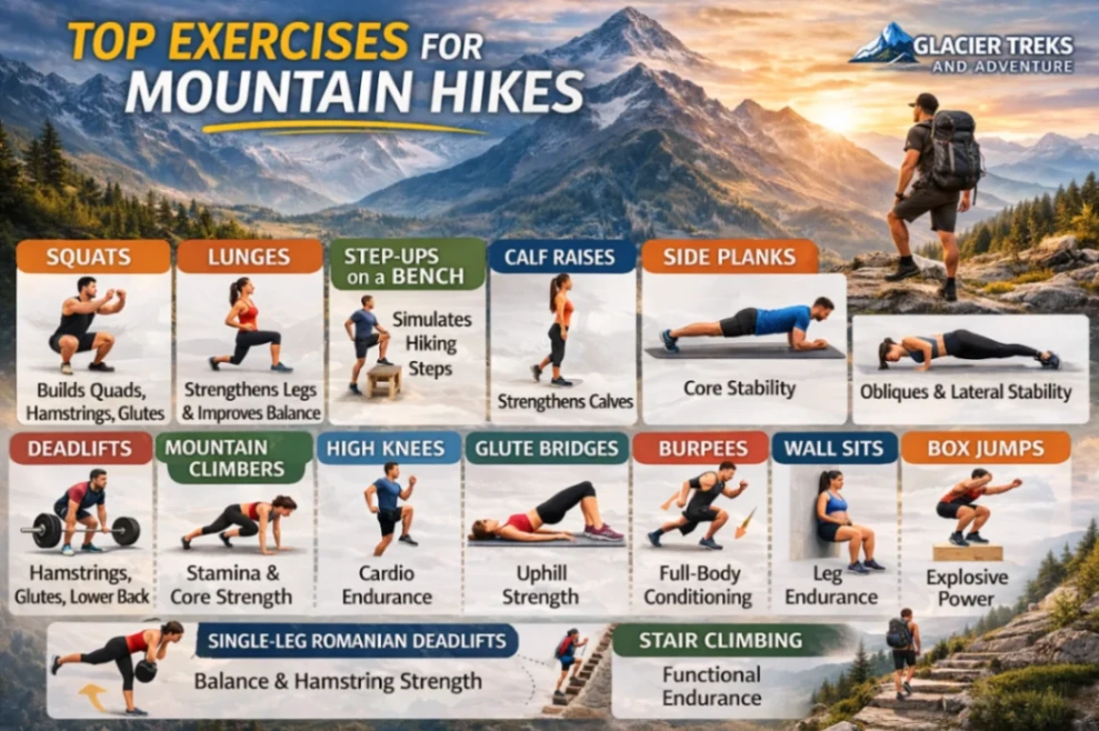
8-week fitness plan before your trek
Most trekkers underestimate the fitness required. Here is the minimum preparation we recommend — start at least 8 weeks before your trek date:
| Week | Cardio | Strength | Endurance test |
| 1–2 | Walk 5km in 50 min, 4 days/week | Bodyweight squats, planks, lunges (20 min, 3 days/week) | — |
| 3–4 | Jog/walk 7km in 70 min, 4 days/week | Add stair climbs with backpack (5kg), 30 min | 5km hill walk in <60 min |
| 5–6 | Run 8km in 60 min, 4 days/week | Loaded squats (8kg), step-ups, calf raises | 10km hill walk in <2 hr |
| 7–8 | Run 10km in 75 min OR cycle 25km | Maintain strength routine | 10km walk with 8kg pack in <2 hr |
If you cannot complete the Week 7–8 endurance test two weeks before the trek, please postpone. We have had to evacuate trekkers from Dzongri because of inadequate fitness, and it is neither fun nor cheap. Honesty with yourself here protects your trek and the safety of the group.
Read more: Full difficulty rating and complete 8-week training plan
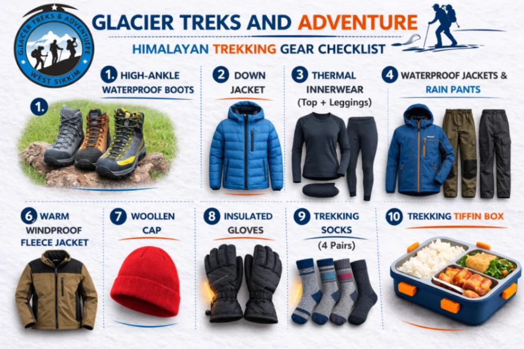
Goechala Trek Packing List
Pack for cold, wind, rain and altitude — sometimes all four in a single afternoon. Below is the minimum list. Anything marked ‘rentable in Yuksom’ can be hired from our base on Day 1 for a daily charge.
Clothing — layering system
- Base layer: 1 thermal top + 1 thermal bottom (merino or synthetic)
- Mid layer: 1 fleece jacket + 1 light down jacket (rentable in Yuksom)
- Outer shell: 1 waterproof and windproof jacket + 1 waterproof trouser
- Trekking pants: 2 pairs (quick-dry, NOT denim or cotton)
- T-shirts: 3 (dri-fit, full sleeve preferred for sun protection)
- Innerwear: 5 pairs
- Socks: 4 pairs (2 thick woollen + 2 trekking socks)
Footwear and accessories
- Trekking shoes: ankle-high, waterproof, broken in (NOT brand new)
- Slippers / camp shoes for evenings
- Woollen cap, sun cap with brim, balaclava
- Sunglasses: UV-400, category 3 or higher (snow-blindness risk above 4,000m)
- Gloves: 1 fleece inner + 1 waterproof outer
- Trekking poles: 1 pair (rentable in Yuksom)
- Headlamp with extra batteries — essential for Summit Day
Gear and miscellaneous
- Backpack: 55–65 litres with rain cover (or 25-litre day pack if you offload)
- Sleeping bag: rated to -10°C (rentable in Yuksom — we provide cleaned & sanitised bags)
- Water bottles: 2 × 1-litre + thermos flask
- Personal medical kit: Diamox, paracetamol, ORS, blister patches, your prescription medicines
- Toiletries: SPF 50+ sunscreen, lip balm, basic kit (carry out all waste)
- Energy snacks: nuts, chocolates, electrolytes for Summit Day
- Documents: photo ID, 3 photocopies, 6 passport photos, travel insurance copy
Read more: Complete packing list with our recommended brands (PDF download)
Permits, Rules and How to Reach Yuksom
Permits required for the Goechala Trek
All Goechala trekking requires three permissions. We handle the entire process for you — but it helps to know what is being done in your name:
- Inner Line Permit (ILP) or, for foreign nationals, the Protected Area Permit (PAP). Issued by Sikkim Tourism. Required documents: passport-size photo + valid government photo ID. Foreigners need a minimum group of two.
- Khangchendzonga National Park entry permit. Paid at the forest check post in Yuksom on the morning of Day 2. Approximately ₹700 per Indian trekker, ₹5,000 per foreign trekker. Camera and additional fees may apply.
- Yuksom Police registration. Mandatory entry at the local police station before the trek begins. Three photocopies of your photo ID needed.
How to reach Yuksom
Yuksom is in West Sikkim, approximately 150km from the nearest railway station (NJP) and airport (Bagdogra). There is no direct flight or train to Yuksom — you transfer by road.
| Mode | Time | Cost (approx) |
| Shared jeep — NJP to Yuksom | 7–8 hours | ₹600–800 per seat |
| Private taxi — NJP/Bagdogra to Yuksom | 6–7 hours | ₹6,500–8,500 per vehicle |
| Glacier Treks shared transfer (per head) | 6–7 hours | ₹3,200 |
Most trekkers fly into Bagdogra airport (IXB) on a morning flight from Delhi, Kolkata or Mumbai, then take a road transfer. NJP railway station is a good alternative if you prefer an overnight train from Kolkata or eastern India. We send a shared vehicle that picks up at both NJP and Bagdogra on Day 1.
Read more: Detailed NJP/Bagdogra to Yuksom transfer guide
Food on the Goechala Trek
Food on the trail matters more than people expect — it is what keeps you warm at 4,000m and what carries you up to Goechala Viewpoint at 3 AM. Our kitchen team carries fresh vegetables, eggs, paneer and basic provisions on mules and yaks. Everything is cooked at camp.
A typical day’s food on the Goechala Trek looks like this:
- 5:30 AM — Bed tea with biscuits, delivered to your tent.
- 7:30 AM — Breakfast: porridge or oats, bread/toast, eggs (omelette or boiled), paratha or puri, tea/coffee, jam, peanut butter.
- 12:30 PM — Lunch (packed on long walking days, hot at camp on short days): rice, dal, sabzi, salad, pickle, papad, fruit.
- 4:00 PM — Evening tea with pakoras, popcorn or biscuits — the day’s most-loved meal.
- 7:30 PM — Dinner: soup, rice, roti, dal, sabzi, paneer or egg curry on alternate days, dessert (kheer or custard) twice during the trek.
Vegetarian, vegan and Jain food is available with prior intimation. We do not serve meat on the trek — it is hard to keep fresh at altitude and most trekkers do not have the appetite for it above 3,500m.
Safety, Acclimatization and AMS
Acute Mountain Sickness (AMS) is the single biggest medical risk on the Goechala Trek. The pass at 4,500m is high enough that anyone — regardless of fitness, age or experience — can develop symptoms. What matters is recognising them early and acting on them.
AMS symptoms to watch for
- Mild: headache, mild nausea, loss of appetite, broken sleep, slight breathlessness at rest
- Moderate: persistent headache that does not respond to paracetamol, vomiting, fatigue beyond expected, dizziness
- Severe (HACE/HAPE): confusion, loss of coordination, pink frothy sputum, breathlessness at rest that does not improve
Mild AMS is normal and roughly 30–40% of our trekkers experience it on Day 4 or Day 5. It is not dangerous if handled. Drink 4 litres of water per day, eat properly even without appetite, do not climb higher until symptoms resolve, and tell your trek leader immediately.
Moderate AMS is a stop signal. We descend by at least 500m and reassess. The package builds in contingency days specifically for this.
Severe AMS is a medical emergency. We descend immediately, administer portable oxygen, and evacuate if necessary. In fifteen years of operating Goechala we have had two evacuations, both successful.
Our safety protocol
- IMF-certified trek leader on every batch
- Portable oxygen cylinder carried at all times above 3,500m
- Pulse oximeter readings taken twice daily from Tshoka onwards
- Diamox (acetazolamide) available for trekkers on doctor advice
- Contingency days at Dzongri built into every itinerary, not charged extra
- Helicopter evacuation arrangement with Yuksom helipad in case of medical emergency
Goechala Trek 2026 Fixed Departures
Below are our confirmed fixed-departure batches for the 2026 season. Each batch is capped at 12 trekkers plus the support team. Booking is on a first-come-first-served basis with a 30% advance to confirm a seat.
| Departure window | Dates | Status | Best for |
| May 2026 | 16 May – 25 May | Limited seats | Late spring rhododendrons |
| May–June 2026 | 30 May – 8 June | Available | Pre-monsoon clear days |
| September 2026 | 19 Sep – 28 Sep | Available | Post-monsoon clarity |
| September 2026 | 27 Sep – 6 Oct | Available | Pre-October crowd |
| October 2026 | 3 Oct – 12 Oct | Available | Peak autumn |
| October 2026 | 10 Oct – 19 Oct | Available | Peak autumn |
| October 2026 | 17 Oct – 26 Oct | Available | Peak autumn |
| October 2026 | 24 Oct – 2 Nov | Available | Peak autumn |
| October–Nov 2026 | 31 Oct – 9 Nov | Available | Crisp, light crowds |
| November 2026 | 7 Nov – 16 Nov | Available | Cold, very clear |
| November 2026 | 21 Nov – 30 Nov | Available | Late autumn |
| December 2026 | 5 Dec – 14 Dec | Available | Strong trekkers only |
| December 2026 | 12 Dec – 21 Dec | Available | -10°C, crystal-clear |
| December 2026 | 26 Dec – 4 Jan | Available | Year-end strong trekkers |
To book, call us on +91 74072 48200 (also WhatsApp), email kiran.yuksom@gmail.com, or use the booking form on our Goechala Trek product page.
Why Trek the Goechala with Glacier Treks & Adventure
There are now more than fifty companies that sell Goechala Trek packages online. Most of them are not actually based in Yuksom and most of them do not operate the trek themselves — they take a booking and forward it to a local operator like us. Booking direct with the operator means the money supports the local Yuksom economy directly and avoids the commission layer that, in our experience, is what most often degrades service quality on the trail.
Here is what makes us different, in plain numbers:
- 15 years operating in West Sikkim, founded in 2010
- 150+ guided treks completed across Sikkim, Ladakh and the Indian Himalaya
- 12,000+ trekkers safely brought back home — including beginners, families, and trekkers from over 25 countries
- Founder Kiran Gurung is an IMF-certified mountaineer and a working trek leader, not a corporate manager
- Affiliated with the Sikkim Department of Tourism, IMF (Indian Mountaineering Foundation), TAAS, YTDC and SAMA
- Yuksom-based — our office is on the main road and you can walk in
- 100% local support team — guides, cooks and porters are all from the Yuksom valley
Frequently Asked Questions
Is the Goechala Trek suitable for beginners?
Goechala is achievable for a beginner who is genuinely fit, but it is not a recommended first trek. The combination of altitude (4,500m), duration (10 days) and remoteness makes it more demanding than introductory treks like Sandakphu or Hampta Pass. If Goechala is your first Himalayan trek, prepare for at least 12 weeks beforehand and consider doing a shorter high-altitude trek like Dzongri first.
What is the actual highest point of the Goechala Trek?
Goechala Viewpoint 1 sits at approximately 4,500m (14,800ft). The original Goechala pass itself, at around 4,940m, lies beyond Viewpoint 1 across a glaciated section that is no longer open to commercial trekking groups. Every operator turns around at Viewpoint 1, including us. This is by park rule, not by choice.
How is the mobile network on the Goechala Trek?
Patchy BSNL and Jio signal up to Yuksom; intermittent at Tshoka if you stand in the right corner of the village; no mobile network for 7–8 days from Day 3 onwards. Tell your family in advance that you will be unreachable. We carry a satellite communicator for emergencies.
What are the toilet arrangements on the trek?
Toilet tents at each campsite — these are dry pit latrines, the most environmentally responsible option at altitude. We clean and re-site them at every camp. There are no Western flush toilets on the Goechala trail. We provide toilet paper but please carry out used hygiene products (a small sealable bag is part of the recommended kit).
Can I offload my backpack?
Yes. For ₹4,500 (full trek) we will offload your main backpack on a mule or yak. You will still need to carry a 25-litre day pack with water, snacks, jacket, headlamp and your camera. We recommend offloading for first-time high-altitude trekkers and anyone over 50.
What is the Goechala Trek cost for foreign trekkers?
The package cost for international trekkers is $400 per person. The Khangchendzonga National Park permit for foreigners is approximately ₹5,000 (around $60) which is paid separately at the forest check post. Foreign trekkers need a Protected Area Permit and must trek in a group of at least two — we handle the permit paperwork.
Are there any age restrictions for the Goechala Trek?
We recommend 13 to 60 years. Trekkers under 18 must be accompanied by a parent or guardian. Trekkers over 55 need a medical clearance from a doctor. We have had healthy 65-year-olds complete Goechala without issue — age matters less than fitness and altitude tolerance.
What if the weather is bad on Summit Day?
We attempt Goechala Viewpoint 1 on Day 7 morning. If the weather is unsafe (heavy snow, very low visibility, dangerous wind chill), the trek leader will call off the summit push. We do not push trekkers into unsafe conditions for a view. If the contingency day at Dzongri has not been used, we can attempt again the next morning. If weather has eaten both days, we descend — your safety is not negotiable for a sunrise photograph.
How much should I tip the trek team?
Tipping is not mandatory but appreciated. Typical contribution from a group: ₹500–1,000 per trekker, pooled and distributed by the trek leader to guides, cooks, helpers and muleteers. The mule team often gets less than the guides — we encourage groups to remember them, since they carry the camp.
Ready to Book Your Goechala Trek?
The Goechala Trek is one of those Himalayan routes that does not get easier the more times you do it — it just gets more meaningful. If you are ready to walk the trail that the kings of Sikkim once watched their kingdom from, our 2026 season is open and we would be glad to welcome you to Yuksom.
Book the Goechala Trek now: ₹19,500 per person
Call/WhatsApp: +91 74072 48200
Email: kiran.yuksom@gmail.com
Read more: View the Goechala Trek product page and book online
Read more: Compare with the shorter 7-day Dzongri Trek
Read more: Starting from Yuksom: the trailhead guide
About the author
Kiran Gurung is the founder of Glacier Treks & Adventure, based in Yuksom, West Sikkim. Born in a remote Sikkimese village, he has spent most of his life on the trails of the Indian Himalaya, working as a guide, expedition leader and mountaineer. He is certified by the Indian Mountaineering Foundation and has led more than 200 Goechala expeditions personally. Glacier Treks & Adventure is affiliated with the Department of Sikkim Tourism, the IMF, TAAS, YTDC and SAMA.